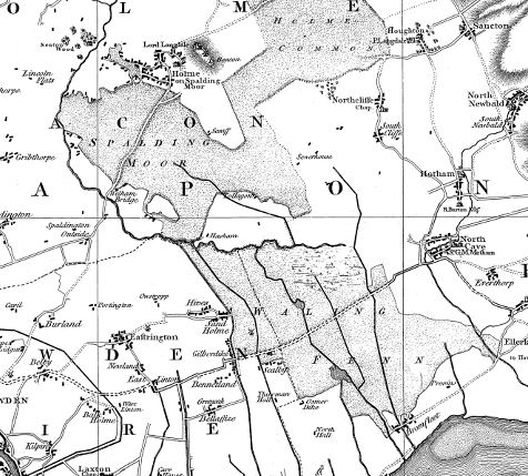
The village of Holme (on-Spalding Moor) is located on the northern side of an area known as Spalding Moor. Until the late 18th century this was a marshy area, and legend says that in order to safely travel between Holme and Welham Bridge you would pay a local hermit/monk to guide you along the correct route through the marshes.
The route may have changed from time to time, as the area could also become flooded with water from the River Humber flowing up tributaries through Walling Fen to the southeast, and along the River Foulness.
In the late 18th century, land drains were run through the fields in the parish which fed into open field ditches, which in turn fed into the River Foulness and the newly cut Market Weighton Canal.
Thomas Jefferys’ map was surveyed just prior to the major drainage of land work commenced